El Salvador Map: Departments, Geography & Travel Basics
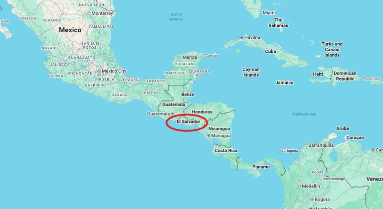
Looking at an El Salvador map is the best way to understand how much beauty fits inside this small but mighty country. From misty volcanoes to golden beaches, the map tells a story of landscapes, culture, and adventure waiting around every corner.
We always tell friends to start their trip planning with an El Salvador map, it helps you see how close everything really is.
Quick Facts About the El Salvador Map
- Location: Central America, between Guatemala and Honduras (Check out our full post on “Where is El Salvador“)
- Pacific Coastline: Yes, surf towns and beaches line the south
- Size: The smallest country in Central America!
- Regions: Mountains, volcanoes, lakes, and coast all within short drives
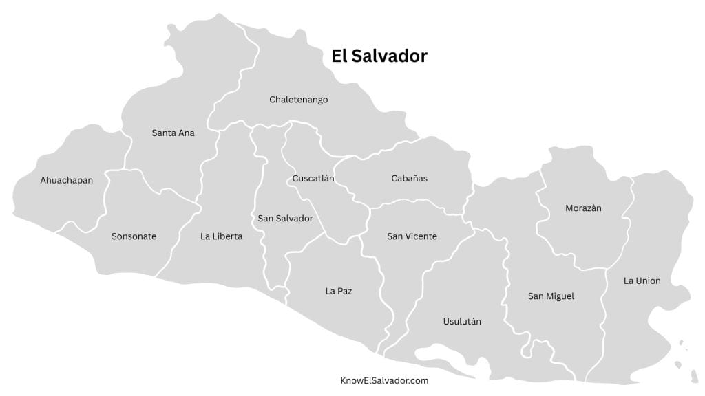
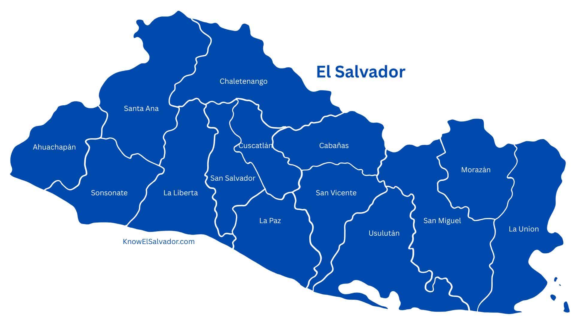
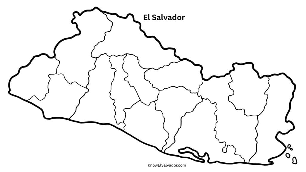
Departments of El Salvador
El Salvador is divided into 14 departments:
- Ahuachapán
- Santa Ana
- Sonsonate
- Chalatenango
- La Libertad
- San Salvador
- Cuscatlán
- Cabañas
- La Paz
- San Vicente
- Usulután
- San Miguel
- Morazán
- La Unión
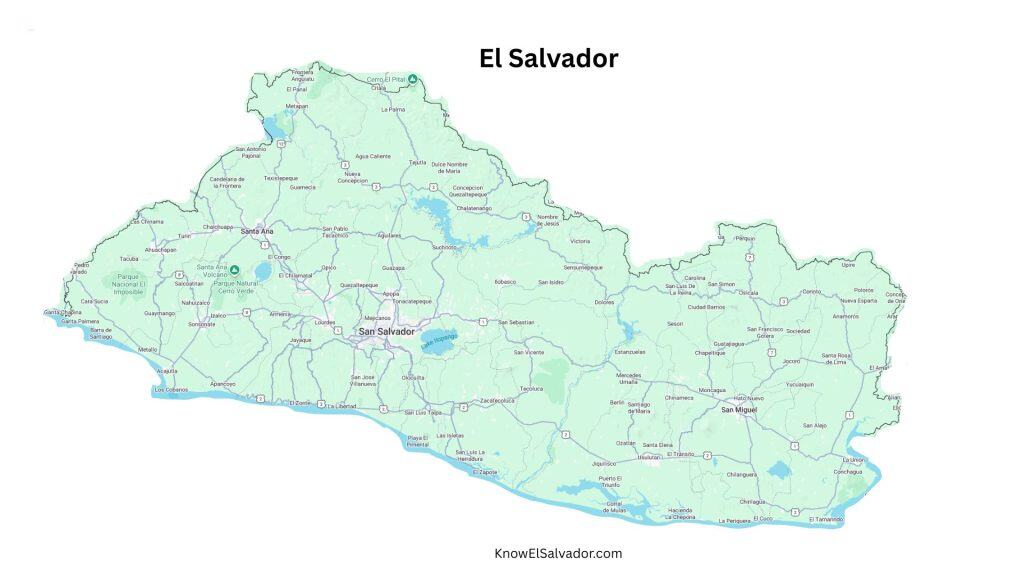
Our El Salvador map images above show department borders, a simple outline, and a Google Maps-style view to help you visualize routes and terrain.
If you’re just getting oriented, check out our guide on where El Salvador is located and tips for finding flights to El Salvador.
Every time Oscar and I look at an El Salvador map, we feel that spark of excitement, because every corner holds a memory, and always a new adventure waiting.